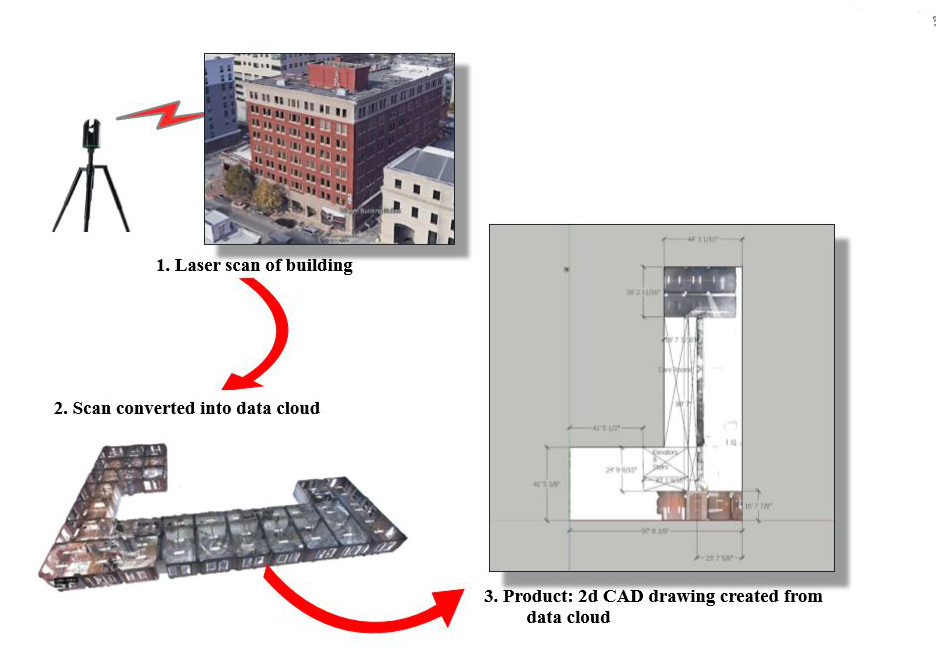
A SCANARCH scanning project begins by conducting a number of laser scans (Approximately, 45′ apart) throughout an area or a building…
Then all scans are registered together to form a data “point-cloud” containing millions of data-points, each geospatial having x, y, & z coordinates
The result is a quick and highly accurate documentation that can be used to produce accurately dimensioned floor plans, reflected ceiling plans, interior and exterior elevations, cross sections, details, etc.
The data can also be used in a variety of ways for digital modeling and measurable walkthroughs, and all data is easily shared digitally.